Sydney residents enjoying a sunny respite after last weekend’s deluge have just another day left of dry conditions, with further rain forecast from tomorrow.
The New South Wales city was drenched with a month’s worth of rain on Saturday and Sunday before the sun broke through yesterday.
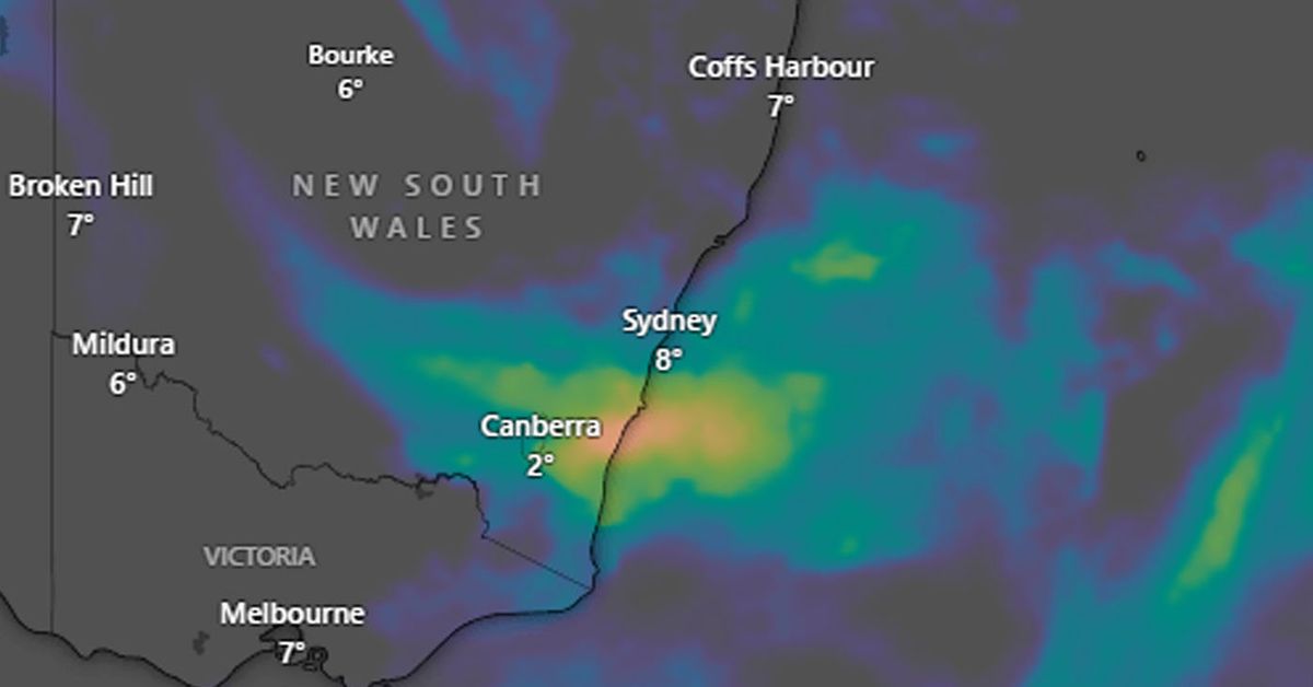
But the Bureau of Meteorology has warned of more wet days ahead, with rain forecast to blanket the city from tomorrow morning through to the long weekend.
A coastal low pressure system is developing off the NSW coast and will bring moderate rain to coastal areas including the Sydney metropolitan region.
The rain will intensify from Thursday for large parts of NSW and eastern Victoria.
There is a 90 per cent chance of rainfall for Sydney on Thursday, with maximum of 30mm.
The good news is that by the King’s Birthday public holiday next Monday, drier conditions will take hold with sunny conditions and a maximum temperature of 19 degrees forecast.
Last weekend’s torrential rain, which caused flash flooding in parts of Sydney, was driven by a rapidly deepening low pressure system over the Tasman Sea.
The most persistent rainfall was in inner-city Sydney with Observatory Hill recording 142mm within just 24 hours, smashing the total monthly average of 133mm for June.
The low formed on Saturday and intensified so quickly that its central pressure dropped rapidly during the 24 hours ending at 4pm on Sunday.
At Sydney’s latitude, this rate of pressure change was enough to classify the system as a “bombing low”, which is the name given to mid-latitude low pressure system that deepens rapidly in a process called explosive bombogenesis.
Abnormally warm sea surface temperatures near Australia’s southern and eastern coastlines may have helped the pressure system undergo bombogenesis.

