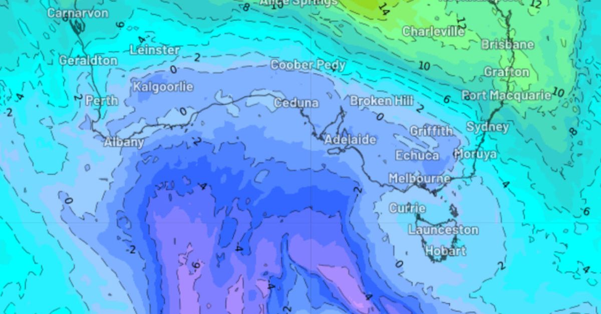
A burst of fierce winds, snow and rain is forecast for southern Australia over the coming days, driven by a looming Antarctic airmass.
The cold and windy weather this week brought a couple of centimetres of snowfall at ski resorts in New South Wales and Victoria yesterday, but is just a taste of what’s to come, forecasters say.
The expected blast of chilly and damp conditions is being driven by a deep low-pressure system tracking towards south-east Australia.
It is forecast to link up with a north-west cloud band and tropical moisture bringing thick cloud and rain from tomorrow.
The cloud band and associated rain will reach Queensland on Sunday, while the low-pressure system will also move an Antarctic airmass over southern Australia from tomorrow and into next week.
This frigid airmass will cause temperatures to drop further on the weekend in Adelaide, with the mercury struggling to reach 14 degrees for about five days, while temperatures in Melbourne will be about 12 degrees.
The colder air will also reach Sydney and Brisbane next week, with the potential for the NSW capital’s maximum temperature to drop to 16 degrees for a day or two.
Chilly nights are also forecast across southeast regions early to mid next week, as the skies clear, causing overnight temperatures to plummet.

There is also the potential for decent snow to fall in the alpine regions from the weekend.
The chilly conditions will be accompanied by strong southerly winds, making the temperature feel much colder than the actual one
Strong winds will begin to impact South Australia tomorrow, with before the gusts reach Victoria, Tasmania, parts of the ACT and NSW on Saturday.

