Locations closer to the centre of the high in south-east Australia are waking up to freezing temperate because the high’s light winds and clear skies create “the perfect conditions for heat to escape overnight”, the Bureau of Meteorology’s Christie Johnson said.
Liawenee, nicknamed “Australia’s coldest town”, lived up to its slogan when residents shivered through a minus 13.5 degree night on Thursday, the second-ever coldest night in Tasmania.
The system has delivered freezing mornings to Melbourne.Credit: Joe Armao
Warrnambool, on the Great Ocean Road in Victoria, hit a record July low of minus 2.4.
The bureau forecasts a chilly morning of one degree in Melbourne on Sunday, a minimum temperature five below average for July.
“Australia’s lowest temperatures always occur under the influence of high pressure systems exacerbating overnight cooling in winter,” Weatherzone’s Ben Domensino said.
“This was the case when Australia registered its lowest temperature on record with minus 23°C at Charlotte Pass, NSW in June 1994.”
The current record-threatening high drifted across the Great Australian Bight last week and became locked over Tasmania due to a split in the jetstream, rivers of fast-moving atmospheric air that usually usher weather systems eastward.
Atmospheric highs in winter normally hit about 1022-1025 hPa. The pressure over parts of Tasmania is sitting at 1043 hPa on Friday morning.
High-pressure systems force the sea level lower by about 1 centimetre per hectopascal, so the bureau expects sea levels near the centre of the high to be about 30cm lower than usual. (The opposite effect during low-pressure storms has the opposite effect and exacerbates coastal flooding.)
The frequency and intensity of highs has increased over the last few decades in Australia, bringing more spells of dry, clear weather.

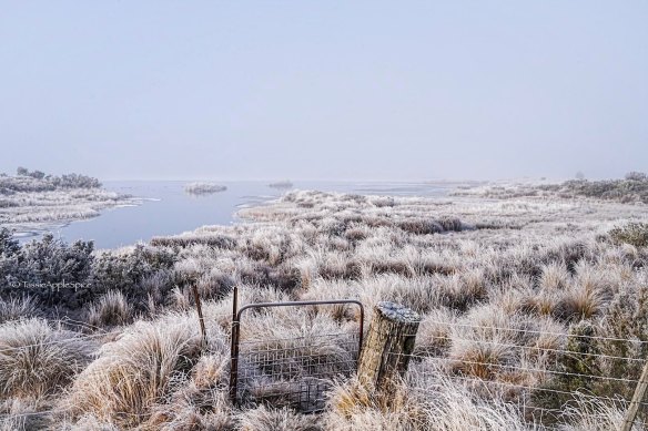
A freezing morning in central Tasmania this week.Credit: Robyn Lewis
The Examine newsletter explains and analyses science with a rigorous focus on the evidence. Sign up to get it each week.

