Coastal NSW may have been the centre of attention the last few days thanks to some very heavy rainfall. But some drought-stricken parts of WA, which you can see in the map below, have now finally received a good dose of rain as well, though mainly close to the west coast.
Image source: Australian Government Bureau of Meteorology
As we mentioned earlier this week, a front was due to cross the state’s southwest from Thursday 6th, bringing heavy rainfall with it. And it delivered.
On Thursday afternoon, the front began to cross the far southwest of the state, affecting areas in and around the major towns of Busselton and Bunbury. Heavy rain and isolated thunderstorms developed, resulting in one-hour rainfall totals of 49.4mm at Paynedale, 41.0mm at Boyanup North, and 37.2mm at Ravenscliffe. A 100km/h wind gust was also recorded at Busselton Jetty.
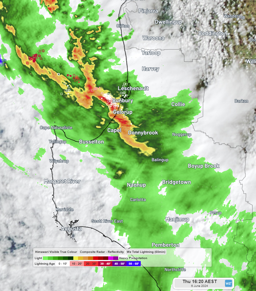 Image: Thunderstorms and heavy rainfall began to affect WA’s far southwest on Thursday afternoon.
The rain continued into the night as the front marched across the southwest, and by 9am yesterday (Friday 7th), Paynedale had amassed a 24-hour total of 66mm. Bickley, a town about 20km east of Perth, had recorded its wettest day in just over a year, with a total of 75.4mm. Further north at Badgingarra, about 50km east of Jurien Bay, 33.6mm was recorded in 24 hours. This may not sound like much, but it did mean that Badgingarra had just experienced its wettest day since August 2022. Also in the 24 hours to 9am yesterday, Ravenscliffe, Glenbrook and Karnet had accumulated 50mm, 48mm and 46mm respectively.
As yesterday unfolded, the rain shifted further north into the state’s midwest, delivering some impressive totals to inland areas near Geraldton. To 9am today, notable totals within a radius of about 150km of Geraldton include:
- 51mm in 24 hours at Wicka
- 24-hour totals of 46.0mm and 45.6mm at Canna and Mullewa respectively—their highest daily rainfall totals since August 2022, as well as being Canna’s wettest June day in 56 years and Mullewa’s wettest June day in 15 years. This rainfall also brought 48-hour totals in Canna and Mullewa to 66.6mm and 69.8mm respectively—the wettest 2-day period in June for both locations in 59 years
- 45mm in 24 hours at Bowgada—its highest daily rainfall since May 2021 and its wettest June day in 3 years. This rainfall also brought Bowgada’s 48-hour total to 64.6mm—its wettest 2-day period in June for 35 years
- 41.8mm in 24 hours at Tardun Hill—its wettest day of any month since August 2022 and its wettest June day since records began at the site in December 2001.
- 41mm in Daisy Downs
Rain and showers have continued across southern and western parts of WA in the hours since 9 o’clock this morning, with Wicka accumulating a further 23mm on top of the 51mm it acquired to 9am yesterday. Coolangatta and Tenindewa have each received 18mm as well. Showers will continue over the region tonight and into tomorrow as this system continues to make its way across the state and another front approaches the state’s southwest from late this evening.
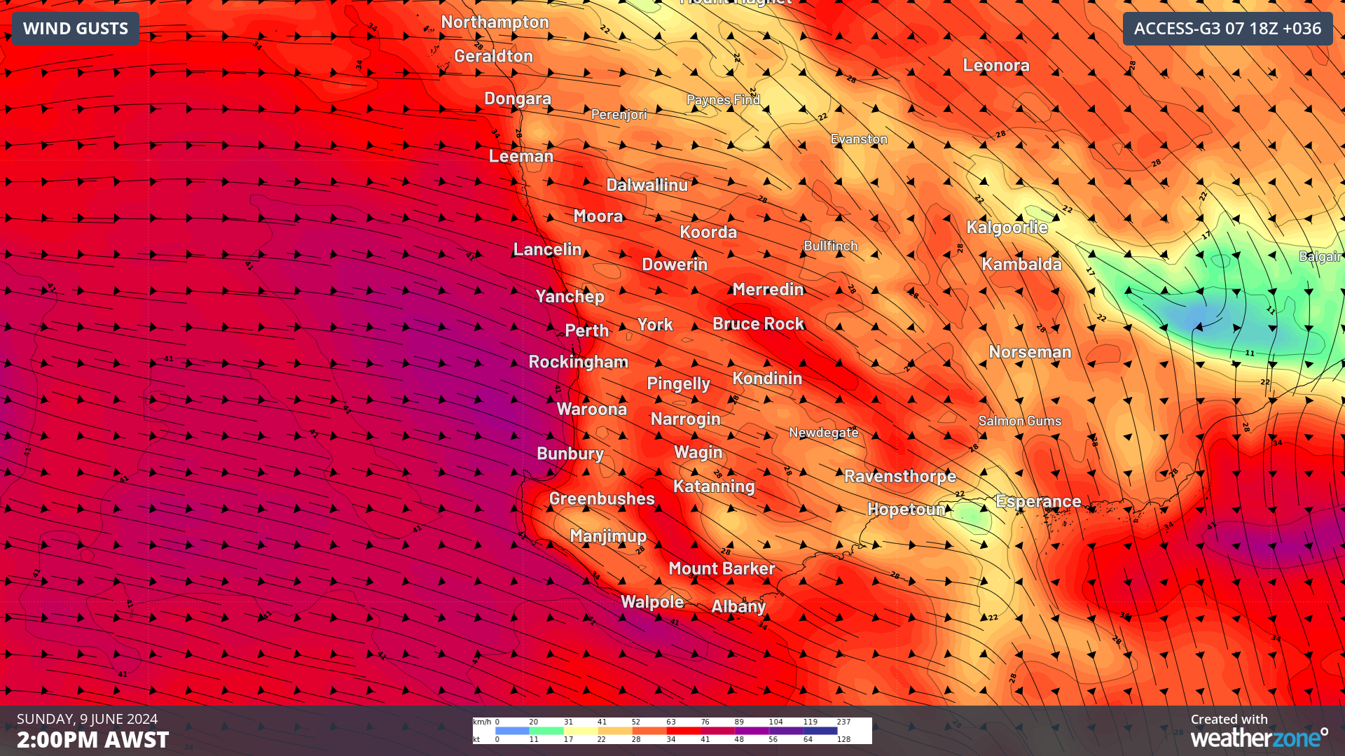
As mentioned earlier in the week, this next front will bring further wet weather. But, as you can see in the image above, it could also bring damaging winds to southwest WA, so make sure you stay up to date with warnings here.