Rain is set to increase on Wednesday, with hundreds of millimetres in just two days possible for the Illawarra and South Coast regions.
An upper-level low will cause rain to spread over eastern Australia in the next three days, with the possibility of heavy falls in NSW and Vic.
The satellite image below shows high levels of atmospheric moisture (blue shades) swirling clockwise around an upper-level low sitting over eastern SA on Tuesday morning.
Image: Himawari-9 satellite water vapour showing the upper-level cut off low near SA at 7:40am AEST on Tuesday, June 4.
This upper-level low is interacting with a surface trough to bring rainfall to much of SA on Tuesday.
During the next 72 hours this low will continue to move east, bringing large rainfall totals to parts of NSW and Vic in the coming days.
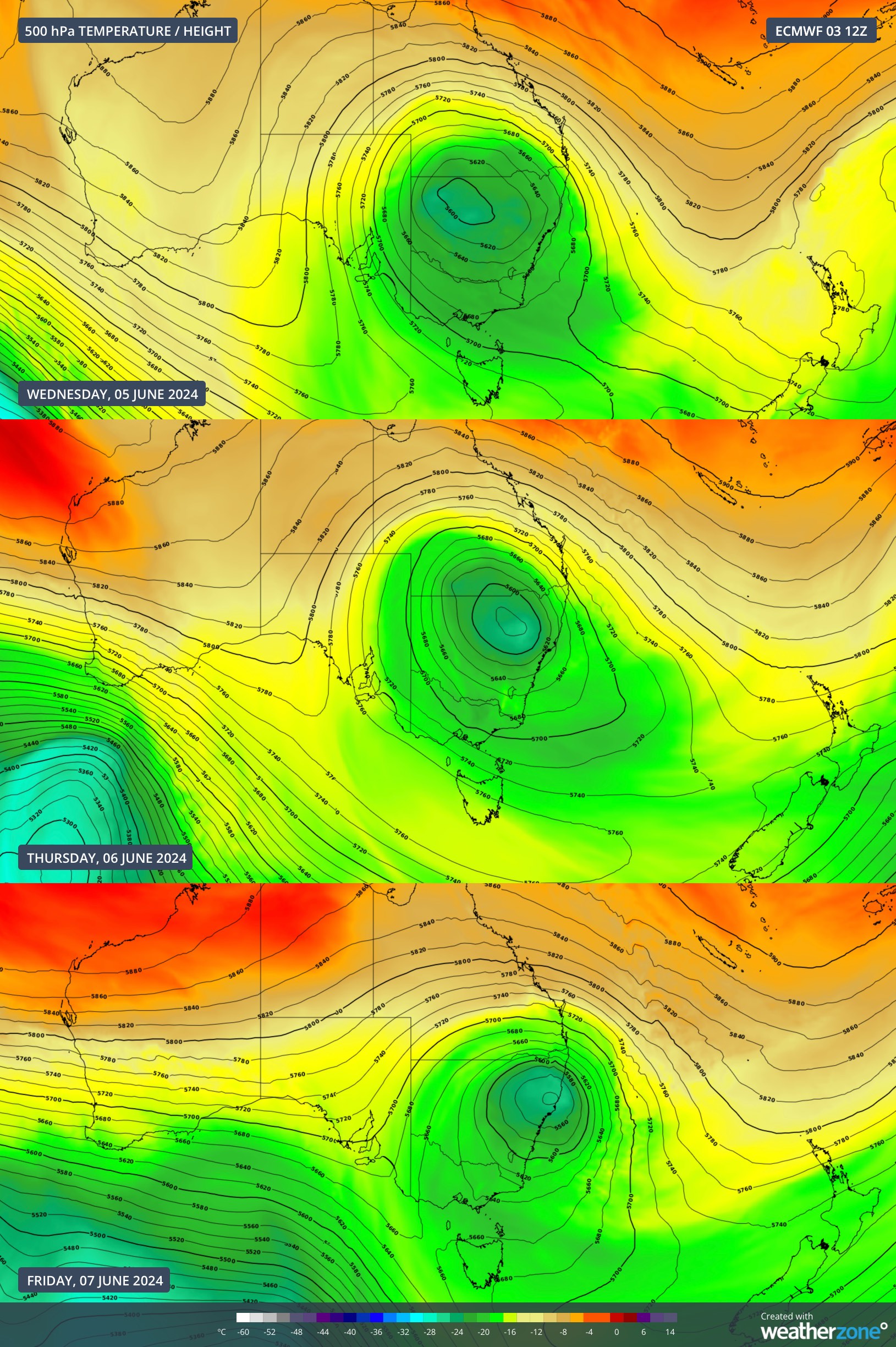
Images: 500 hPa temperature and height on Wednesday, June 5 (top), Thursday (middle) and Friday (bottom), according to ECMWF.
The map below shows that one computer model is forecasting 100 to 250mm across parts of the Illawarra and South Coast in the next 72 hours, in response to this upper-low.
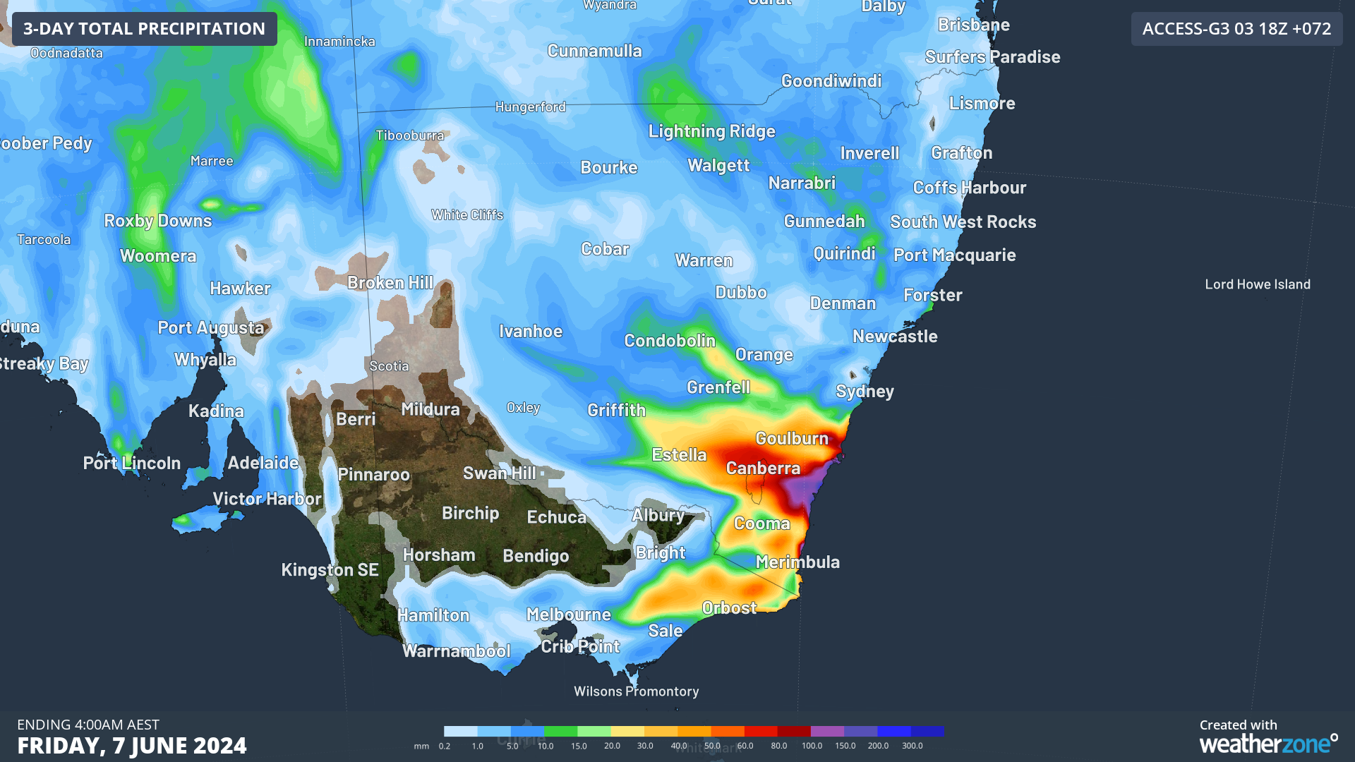
Image: Accumulated precipitation for the 3 days leading up to 4am AEST on Friday, June 7, according to Access-G
Much of this rain should fall on Wednesday and Thursday, in response to the surface trough and low development.
On Wednesday, the rain will focus on the Illawarra, South Coast and Southern Tablelands districts in NSW, with widespread falls of 20 to 40mm forecast. Isolated areas of the South Coast could see 60-80mm in 24 hours on Wednesday, as a coastal trough develops in response to the upper-low.
Large totals are forecast again on Thursday in this region, as a surface low pressure system develops within this trough off the NSW coast. Models are suggesting that isolated areas could see 80-150mm anywhere along the coast between Sydney and Mallacoota on Thursday. There is still some uncertainty on where the surface low will develop and therefore where the heaviest falls will occur.
Rain is expected to ease slightly on Friday; however, the showers will continue across the southeast over much of the weekend. As this event unfolds please keep an eye out for the latest warnings.